Post by Muleskinner on Feb 12, 2012 19:17:52 GMT -8
A few years back My wife, me and her cousins decided we were going to take a jont to Eden Ridge a little south east of Powers Oregon and look for the very least pictured and talked about Camp 7, which belonged to Smith-Powers Lumber Company back in the glory days of logging.
Based in Marshfield (Coos Bay) Oregon back in the turn of the century Rails were eventually pushed into Coquille, Norway, Myrtle Point and then on to the Mountain settlement of powers and into the big fir country of Coos County. The rails were built to follow the Coquille river up to Myrtle Point and then they continued to follow the South fork of the river through its treacherous and winding valleys to the town of power about 40 miles up river.
The rails have since been torn up and removed and what deemed impossible to reach they were simply pushed over the cliffs into the river below, much to the discontent of the state. Powers, Oregon was once a thriving town with a size able population due to the mill which smith powers built in the turn of the century and the other small gypo mills which grew up around the area. The town of powers ultimately grew up around these mills and present day Powers shows a lot of its early heritage in its buildings today.
The town relied on what goods were grown in the small valley by settlers and what could be brought in by rail or freight wagon, the latter taking nearly a week to make journey from Powers to the Coquille valley and back along a winding and treacherous road which followed the South fork of the Coquille river. Before the loggers the road was a trail etched out along the bluffs by Miners making their way to the Iron Mountain area and the Rouge River Valley in search of Gold and other valuables. The Indians of this area were always a threat to contend with as the rouge Valley was considered a sacred place to them. It wasn't till the end of the rouge river Indian wars and a treaty was signed which guaranteed the safety of the settlers which flooded into the area after wards. And with these settlers came the loggers.
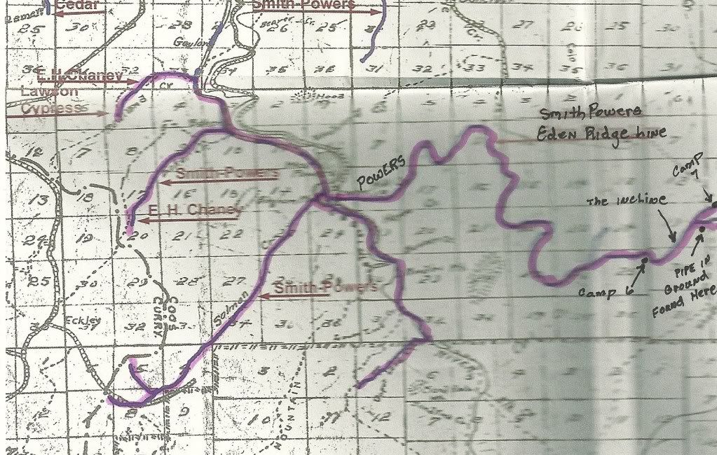
The old map which I obtained of the original route of the Smith-Powers Logging rails. Our destination was the forks in the lower right hand corner. The arrowed items will be covered in the post.
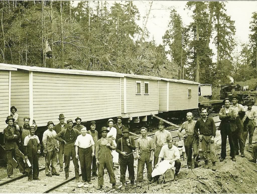
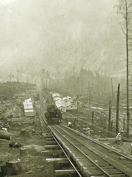
Our destination. This is the only picture I could find of Camp 7 at the top of the incline on Eden Ridge. It clearly shows the camp cars and a few of the cooks, loggers and what not who occupied them. From my best interpretation of this photo, it was taken when the mobile units were being lowered back down the incline after the logging petered out on the ridge. The lokie in the back ground is spotting log cars at the top of the incline for lowering down the ridge.
The area was so rugged that most logging was done with the logging cars being loaded and spotted on trestles most of the time. They had to be hauled up inclines when it was impossible to lay track where the slopes tended to go straight up at more of an angle than the Lokies of the time could traverse.
This area was as one logger put it was so rugged the mountain lions and rattler didn't want it. I thought it was a joke until We finally made it into the area in cousin Dave's motor home. Even in the modern days the paved road is winding and follows closely the old rail lines which were cut along the bluffs into the area. Its also a narrow one lane road at times where in the motor home the rear wheels seemed to be hanging out in mid air along the shoulder. We were also pulling a twelve foot utility trailer which was carrying our four wheelers and Dave's motor cycle, which were to be used as transportation in the mountains. It also carried our other implements for survival or destruction, which ever came first.

Water fall along the main road.

The river below the falls. I had to use my zoom and bring the photo into focus as at the bottom of the falls it looked like a mere point in the valley below.
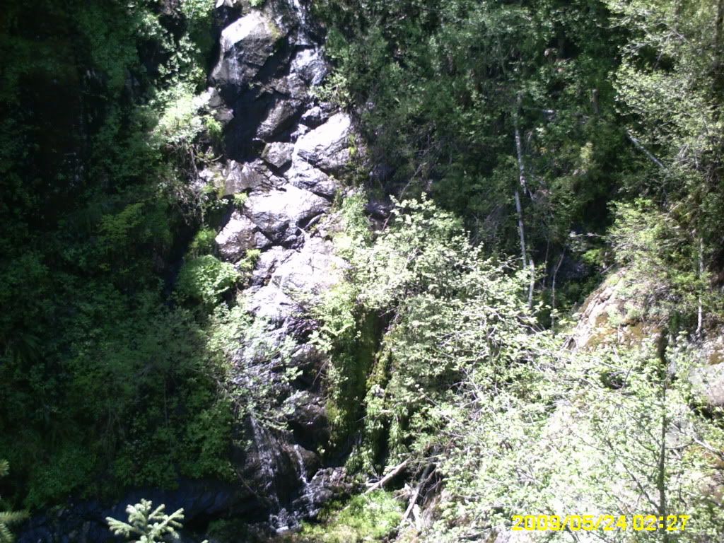
Another shot along the road as we neared the top and broke into Eden Valley. From this point we were 15 miles from our destination at the foot of Eden ridge.
After we reached the top of the climb and the flat ground expanse of Eden Valley we found long gone but State marked mining claims from when the miners came into this area in the late 1800's in search of gold. In some places you could still find the ruins of an occasional cabin or homestead whose occupiers had long disappeared into history.
As we continued on through the wooded area of the valley, we finally rounded a corner and there before us in the distance was our destination, Eden Ridge. It was a forbidding ridge line which was jagged with rocks and clearly showed the clear cutting of earlier years in Smith-Powers history. It was if we had driven back in time as we turned of the main road and made our way up the valley as Far as we could in the Motor home and found a descent enough place to set up base camp and unload our equipment.
We spent the first day setting up camp and getting the four wheelers and Cycle ready for the next day adventure. After we had eaten supper I decided to go on a scouting trip on one of the four wheelers to the base of the ridge and see what lay ahead. I started up a logging road which looked decent enough but hadn't been used for a long time and was over grown with trees and followed it about two or three miles until I broke onto a cross road at the top. There I turned of to the right and found myself on the roughest road I had ever been on and stopped. I stopped and got off the four wheeler and walked ahead a little ways and then began kicking the dirt around. To my astonishment I had been riding over one of the old railroad lines where the rails were removed and the ties left in place. I got back on the four and followed them a little further until the line ended at a massive drop off with the old remains of the trestle in the canyon below.
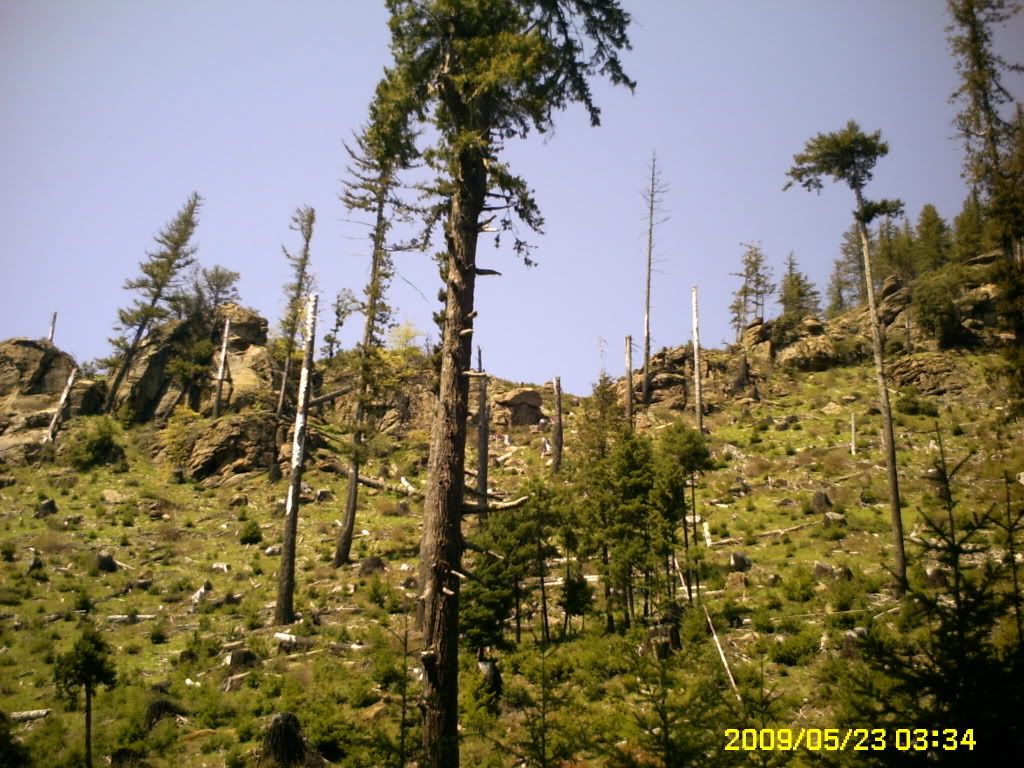
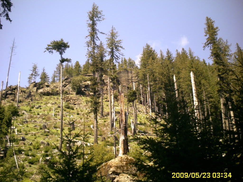
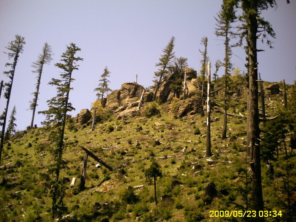
A panoramic view of Eden Ridge.

The trestle works long since fallen in the valley below where the line ended. This photo was once more taken at maximum zoom in.
After finding that we were in the right area, I returned to camp and talked to Dave about our plan of attack on the ridge and came to the agreement it wasn't going to be easy.
The next day started at the crack of 12 AM and we loaded up and started up the mountain to the road I had found the day before. At the top we scanned the area at the edge of the trestle break and in the distance we found another road which was in better shape. Now the problem was getting to it. We were armed with a BLM map of the area which in Oregon is about as reliable as a chipmonk attacking a cougar and found all kinds of solid lines dotted lines which showed roads and a round brown knoll listed which turned out to be a coffee spill from the night before. After some careful concideration we decided to go back down the mountain to the main cattle trail and folow it to see if we could find a lead in road to the one we spotted at the trestle break. After riding about twenty minutes we found a road which looked as though it were graded recently by a large herd of Elk dragging their feet and followed it up the mountain.
When we reached the top we stopped and looked for any signs of the Treatle break across the valley. Thats when I heard Dave exclaim "AHA!"to which I replied "WHAT!" .
"We're lost he said with a disgusted look."
We were about to give up when around the corner came a pickup like a bat out of hell, stopped and ask if we were lost. I told him no we were just having trouble reading the BLM Map we had. We showed it to him and upon looking at it said the brown mountain he didn't reconize. Dave told him it was mount Folgers to which the driver of the pickup gave him a dumb look in reply. We told him it was a coffe stain which he kind of cut a smile and then looked once more at the map.
We told him where we were earlier which he called wash board road and then showed us where we were now. He then took a pencil and started tracing some lines along the roads and told us if we follow the routen he marked we would be exactly across from the Trestle Fall. He then handed us back the map and waved as he drove off. Once more we were on the road again and following the route he had marked off on the map.
Rounding a corner we stopped and there above us was the trestle Break about a quarter mile away. We followed the road further and it crossed right through the trestle ruins which were pushed out of the way for road building.
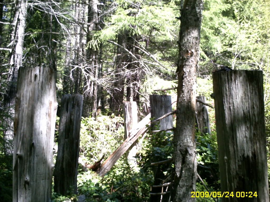
Trestle remnents at the bottom of the Break.
We followed the road further and came to the end of the marked area which the driver of the pickup lined out and stopped again. The road forked three ways and was all good road, but our problem was the rails went up and the good roads went down.
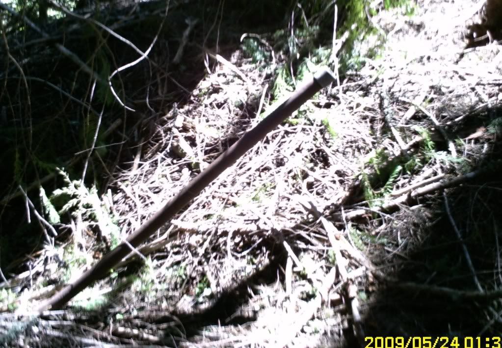
after surveying the area we found another old partially grown over road and started up it. After a while we found ourselves on another wash board road of ties and dirt which led to the base of a hill where we found miles and miles of old abandoned haywire of various sizes all over the place. After some more scouting around we found the ties went in a straight line up the side of the mountain. We were at the start of the incline and where we were standing was the site of Camp 6 which was built at the bottom of the the ridge. We spent some time looking around but didn't find anything except a rail spike and more of the hay wire which we found earlier. It was getting late and we decided to retreat back to camp and continue our attack the next day.
Next morning we studied the area where we were on the map and found that there was a dotted line around the backside of the ridge which came off the right fork of the intersection and squirreled to the top of the ridge. So with map in hqnd we sat off once more.
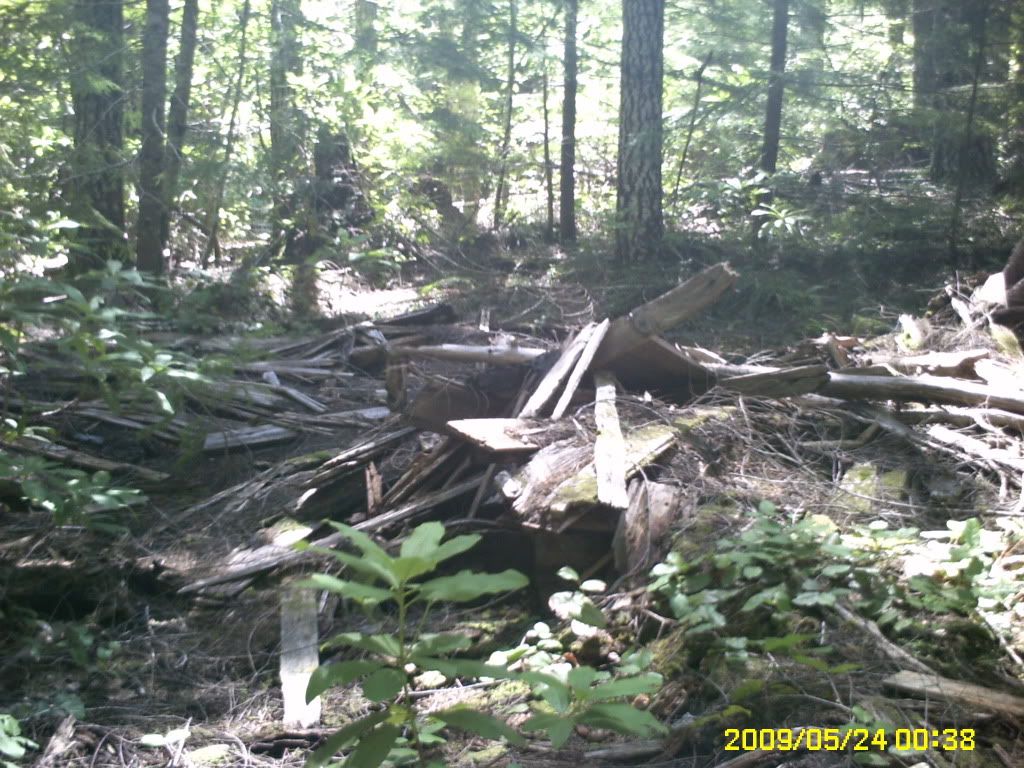
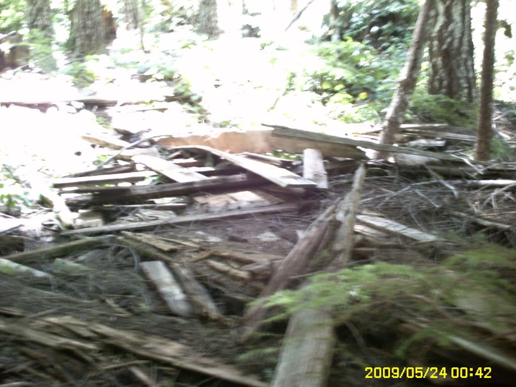
We arrived at the intersection and turned right onto the road. After about a mile, we found the road or I should say path that went up the ridge. We began following it and in about an hour we finally broke out on top and found ourselves once more on a wash board road. All around there were trestle works laying on the ground and some still standing going every which way. across the ridge. We were at the top of the incline.
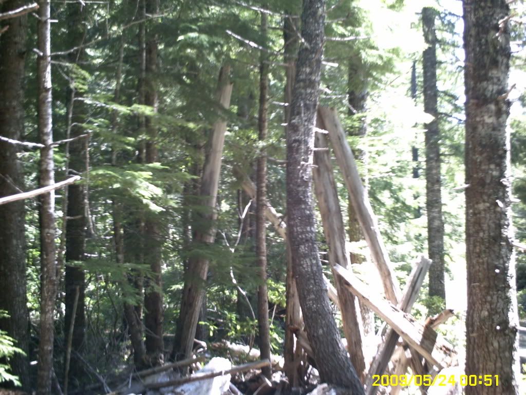

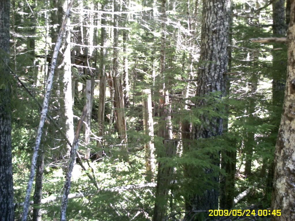
Remains of trestle works in the trees at the top of the ridge.
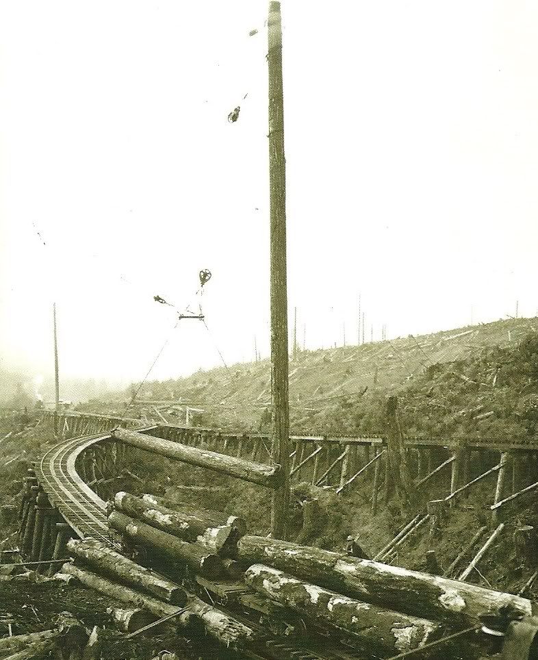
Original trestle work at the top of the ridge.
Camp 6 seen from a third of the way up the incline. Further up the hill from this location would be the start of the passing track for the log buggies going up to the top of the ridge for loading and loaded buggies coming down through Camp 6. The encline continued for about two to three miles more over the ridge beyond the camp, to the staging yard in the valley. From there the logs were transported to the mills at Powers and further on to Marshfield(Coos Bay).
To Be continued.
Based in Marshfield (Coos Bay) Oregon back in the turn of the century Rails were eventually pushed into Coquille, Norway, Myrtle Point and then on to the Mountain settlement of powers and into the big fir country of Coos County. The rails were built to follow the Coquille river up to Myrtle Point and then they continued to follow the South fork of the river through its treacherous and winding valleys to the town of power about 40 miles up river.
The rails have since been torn up and removed and what deemed impossible to reach they were simply pushed over the cliffs into the river below, much to the discontent of the state. Powers, Oregon was once a thriving town with a size able population due to the mill which smith powers built in the turn of the century and the other small gypo mills which grew up around the area. The town of powers ultimately grew up around these mills and present day Powers shows a lot of its early heritage in its buildings today.
The town relied on what goods were grown in the small valley by settlers and what could be brought in by rail or freight wagon, the latter taking nearly a week to make journey from Powers to the Coquille valley and back along a winding and treacherous road which followed the South fork of the Coquille river. Before the loggers the road was a trail etched out along the bluffs by Miners making their way to the Iron Mountain area and the Rouge River Valley in search of Gold and other valuables. The Indians of this area were always a threat to contend with as the rouge Valley was considered a sacred place to them. It wasn't till the end of the rouge river Indian wars and a treaty was signed which guaranteed the safety of the settlers which flooded into the area after wards. And with these settlers came the loggers.

The old map which I obtained of the original route of the Smith-Powers Logging rails. Our destination was the forks in the lower right hand corner. The arrowed items will be covered in the post.

Our destination. This is the only picture I could find of Camp 7 at the top of the incline on Eden Ridge. It clearly shows the camp cars and a few of the cooks, loggers and what not who occupied them. From my best interpretation of this photo, it was taken when the mobile units were being lowered back down the incline after the logging petered out on the ridge. The lokie in the back ground is spotting log cars at the top of the incline for lowering down the ridge.
The area was so rugged that most logging was done with the logging cars being loaded and spotted on trestles most of the time. They had to be hauled up inclines when it was impossible to lay track where the slopes tended to go straight up at more of an angle than the Lokies of the time could traverse.
This area was as one logger put it was so rugged the mountain lions and rattler didn't want it. I thought it was a joke until We finally made it into the area in cousin Dave's motor home. Even in the modern days the paved road is winding and follows closely the old rail lines which were cut along the bluffs into the area. Its also a narrow one lane road at times where in the motor home the rear wheels seemed to be hanging out in mid air along the shoulder. We were also pulling a twelve foot utility trailer which was carrying our four wheelers and Dave's motor cycle, which were to be used as transportation in the mountains. It also carried our other implements for survival or destruction, which ever came first.

Water fall along the main road.

The river below the falls. I had to use my zoom and bring the photo into focus as at the bottom of the falls it looked like a mere point in the valley below.

Another shot along the road as we neared the top and broke into Eden Valley. From this point we were 15 miles from our destination at the foot of Eden ridge.
After we reached the top of the climb and the flat ground expanse of Eden Valley we found long gone but State marked mining claims from when the miners came into this area in the late 1800's in search of gold. In some places you could still find the ruins of an occasional cabin or homestead whose occupiers had long disappeared into history.
As we continued on through the wooded area of the valley, we finally rounded a corner and there before us in the distance was our destination, Eden Ridge. It was a forbidding ridge line which was jagged with rocks and clearly showed the clear cutting of earlier years in Smith-Powers history. It was if we had driven back in time as we turned of the main road and made our way up the valley as Far as we could in the Motor home and found a descent enough place to set up base camp and unload our equipment.
We spent the first day setting up camp and getting the four wheelers and Cycle ready for the next day adventure. After we had eaten supper I decided to go on a scouting trip on one of the four wheelers to the base of the ridge and see what lay ahead. I started up a logging road which looked decent enough but hadn't been used for a long time and was over grown with trees and followed it about two or three miles until I broke onto a cross road at the top. There I turned of to the right and found myself on the roughest road I had ever been on and stopped. I stopped and got off the four wheeler and walked ahead a little ways and then began kicking the dirt around. To my astonishment I had been riding over one of the old railroad lines where the rails were removed and the ties left in place. I got back on the four and followed them a little further until the line ended at a massive drop off with the old remains of the trestle in the canyon below.


A panoramic view of Eden Ridge.

The trestle works long since fallen in the valley below where the line ended. This photo was once more taken at maximum zoom in.
After finding that we were in the right area, I returned to camp and talked to Dave about our plan of attack on the ridge and came to the agreement it wasn't going to be easy.
The next day started at the crack of 12 AM and we loaded up and started up the mountain to the road I had found the day before. At the top we scanned the area at the edge of the trestle break and in the distance we found another road which was in better shape. Now the problem was getting to it. We were armed with a BLM map of the area which in Oregon is about as reliable as a chipmonk attacking a cougar and found all kinds of solid lines dotted lines which showed roads and a round brown knoll listed which turned out to be a coffee spill from the night before. After some careful concideration we decided to go back down the mountain to the main cattle trail and folow it to see if we could find a lead in road to the one we spotted at the trestle break. After riding about twenty minutes we found a road which looked as though it were graded recently by a large herd of Elk dragging their feet and followed it up the mountain.
When we reached the top we stopped and looked for any signs of the Treatle break across the valley. Thats when I heard Dave exclaim "AHA!"to which I replied "WHAT!" .
"We're lost he said with a disgusted look."
We were about to give up when around the corner came a pickup like a bat out of hell, stopped and ask if we were lost. I told him no we were just having trouble reading the BLM Map we had. We showed it to him and upon looking at it said the brown mountain he didn't reconize. Dave told him it was mount Folgers to which the driver of the pickup gave him a dumb look in reply. We told him it was a coffe stain which he kind of cut a smile and then looked once more at the map.
We told him where we were earlier which he called wash board road and then showed us where we were now. He then took a pencil and started tracing some lines along the roads and told us if we follow the routen he marked we would be exactly across from the Trestle Fall. He then handed us back the map and waved as he drove off. Once more we were on the road again and following the route he had marked off on the map.
Rounding a corner we stopped and there above us was the trestle Break about a quarter mile away. We followed the road further and it crossed right through the trestle ruins which were pushed out of the way for road building.

Trestle remnents at the bottom of the Break.
We followed the road further and came to the end of the marked area which the driver of the pickup lined out and stopped again. The road forked three ways and was all good road, but our problem was the rails went up and the good roads went down.
after surveying the area we found another old partially grown over road and started up it. After a while we found ourselves on another wash board road of ties and dirt which led to the base of a hill where we found miles and miles of old abandoned haywire of various sizes all over the place. After some more scouting around we found the ties went in a straight line up the side of the mountain. We were at the start of the incline and where we were standing was the site of Camp 6 which was built at the bottom of the the ridge. We spent some time looking around but didn't find anything except a rail spike and more of the hay wire which we found earlier. It was getting late and we decided to retreat back to camp and continue our attack the next day.
Next morning we studied the area where we were on the map and found that there was a dotted line around the backside of the ridge which came off the right fork of the intersection and squirreled to the top of the ridge. So with map in hqnd we sat off once more.
We arrived at the intersection and turned right onto the road. After about a mile, we found the road or I should say path that went up the ridge. We began following it and in about an hour we finally broke out on top and found ourselves once more on a wash board road. All around there were trestle works laying on the ground and some still standing going every which way. across the ridge. We were at the top of the incline.


Remains of trestle works in the trees at the top of the ridge.

Original trestle work at the top of the ridge.

Camp 6 seen from a third of the way up the incline. Further up the hill from this location would be the start of the passing track for the log buggies going up to the top of the ridge for loading and loaded buggies coming down through Camp 6. The encline continued for about two to three miles more over the ridge beyond the camp, to the staging yard in the valley. From there the logs were transported to the mills at Powers and further on to Marshfield(Coos Bay).
To Be continued.

